3D Laser Scanning Services in Nigeria
High-speed terrestrial laser scanning capturing millions of data points per second for complete spatial documentation of any environment.
Get a Free QuoteOverview
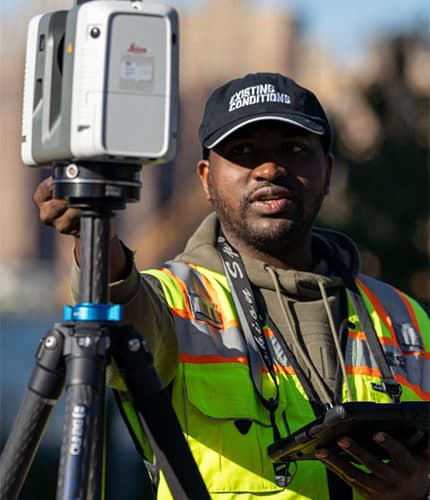
3D laser scanning is the fastest and most accurate way to capture the exact geometry of a building, plant, or site. Our terrestrial scanners record millions of measurement points per second, producing a dense point cloud that documents every visible surface with accuracy to ±2mm.
TruePoint Capture deploys scanning teams from Lagos to project sites across Nigeria — refineries in Port Harcourt, high-rise construction in Victoria Island, manufacturing plants in Ogun State, and infrastructure projects nationwide. Field capture is typically completed in days rather than the weeks required by manual survey methods, keeping site disruption to a minimum.
Every project is planned around your deliverables. Whether you need a registered point cloud for retrofit design, 2D drawings of an existing building, or the foundation data for a BIM model, we design the scan coverage, control network, and registration workflow to match the accuracy your engineers require.
What's Included
- Terrestrial and tripod-mounted scanning with survey-grade instruments
- High-density point cloud capture at up to 2 million points per second
- Colour-mapped scan data with photographic overlays
- Survey control integration for georeferenced deliverables
- Scanning of live industrial sites with minimal operational disruption
- Rapid mobilisation across Nigeria and West Africa
3D Laser Scanning — Frequently Asked Questions
How accurate is 3D laser scanning?
How long does a 3D laser scan take in Nigeria?
Can you scan an operating facility without shutting it down?
More questions? See our full FAQ or contact our team.
Related Services
Scan to BIM
Convert point cloud data into intelligent BIM models for renovation, retrofit, and facility management projects across Nigeria.
Digital Twin
Build virtual replicas of physical assets for real-time monitoring, simulation, and data-driven decision making.
As-Built Documentation
Accurate as-built records of existing structures, pipelines, and facilities — eliminating costly site revisits and design clashes.
Point Cloud Processing
Expert registration, cleaning, and deliverable generation from raw scan data — point clouds, meshes, 2D drawings, and 3D models.
Need 3D Laser Scanning in Nigeria?
Tell us about your project and we'll recommend the optimal approach with a detailed, transparent quote.